

The Water is Here
Introducing an occasional newsletter from the Mean High Water Project

Welcome to the first dispatch of the Mean High Water newsletter. This will be an evolving experiment, but I hope to provide occasional updates on flooding, sea level rise, and other topics loosely related to the water here in the Lowcountry. It was about a year ago I launched the Mean High Water Project, and I’ve been overwhelmed by the response so far. Thanks for your support, and I hope you’ll subscribe to and share this newsletter.
The headline of this first edition is inspired by Jeff Goodell’s 2017 book The Water Will Come, a deep dive on the impacts of the coming waters on cities and societies around the globe. If you haven’t read the book, I highly recommend picking it up from your local bookseller or library. As the significant tidal flooding we experienced here in the Charleston Area and across the southeast coast show, the water is here and still coming.
Hurricane Hugo’s Flooding - 2021, 2050, 2100
The Circular Congressional Church on Meeting Street in Charleston’s French Quarter recently installed a ‘Blue Line Project’ showing the elevation that Hurricane Hugo’s surge would reach if the hurricane hit today, in 2050, and in 2100. Hugo, which made landfall on Sept. 21, 1989, produced the flood-of-record for Charleston Harbor (12.52-feet on mean lower low water datum), so it’s a tangible flood to conceptualize. The potential impacts of flooding from an equivalent hurricane today and in the future are pretty eye-opening, especially when you think about the storm’s path. Hugo’s peak storm tide was approximately 20-feet in Bulls Bay, so the City could’ve seen a much higher surge had the storm made landfall a few miles to the south. You can read more on this important project at the project’s website and in the Charleston City Paper.
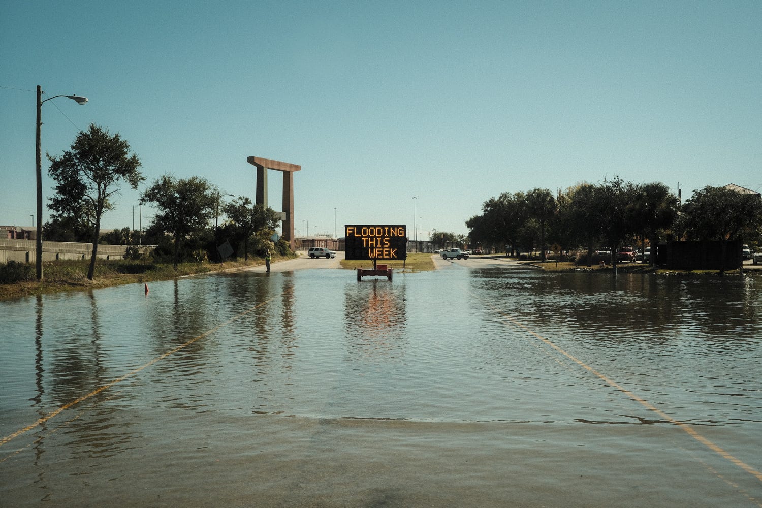
On Flooding in Charleston
In advance of the predicted tidal flooding between Nov. 5th and 8th, I shared a post on Instagram discussing the potential for Charleston to experience the 6th highest tide on record (luckily it didn’t get quite that high). I received several questions about the impacts and severity of the flooding and how it might compared to other floods from this year. I thought it was a good time to discuss the different types of flooding we are vulnerable to in Charleston.

Common High Ground
Spencer George, who publishes Good Folk, recently had a piece, Common High Ground, published in the Bitter Southerner that investigates how “Charleston’s artists are responding to climate change.” I’m honored that Spencer reached out to me to discuss the Mean High Water Project and included some of my photography in the story. Be sure the subscribe to Spencer’s newsletter, Good Folk.
In other news…
As I write this newsletter, the true scale of the impacts of the flooding in British Columbia are still becoming clear. Essentially, the ports in the Vancouver-area, significant channels of the already strained supply chains, are cut-off from the rest of Canada by road and rail. Area’s of western Canada and the US Pacific Northwest, just months removed from devastating heatwaves and wildfires, are seeing damages to basic infrastructure that we are unprepared to handle.