A Record-Setting Nor'easter Flood in Charleston
On Sunday, December 17th, Charleston experienced it's 4th highest tidal flood on-record associated with the passing of a nor'easter.

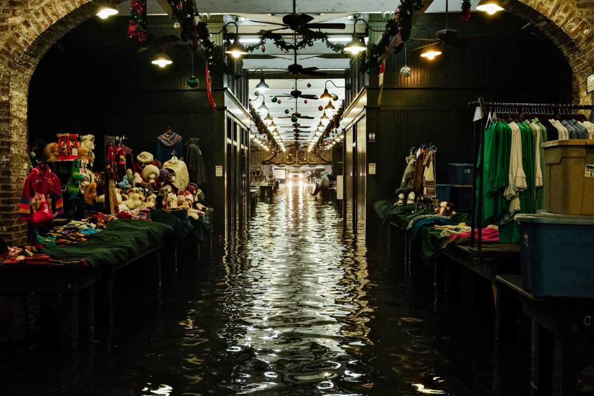
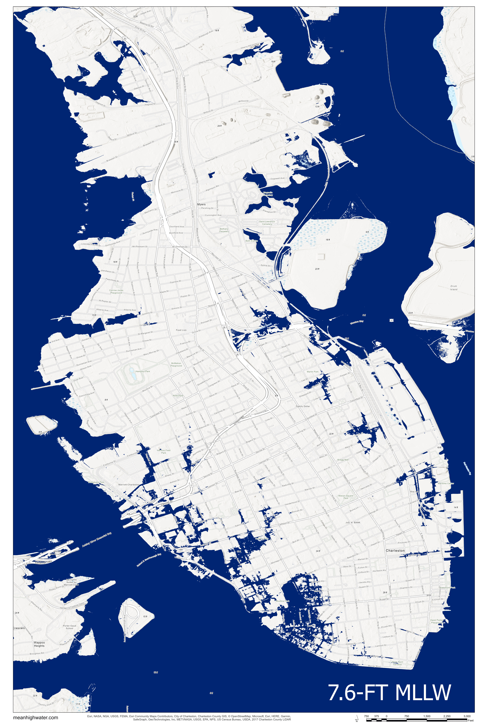
The nor’easter that impacted the Charleston region on December 17th wasn’t exactly a surprise, but the impacts from it were much more significant that anyone expected. In the days leading up to the storm, forecasts called for moderate tidal flooding (7.6-ft MLLW), with additional compounding flood risk associate with the potential for heavy rainfall. Updated forecasts on Saturday evening and then Sunday morning raised the predicted tide levels into the major flooding threshold (8.2 and 8.3-ft MLLW, respectively) around the 11:17AM high tide, which significantly increases the impacts from flooding across Charleston, particularly on the peninsula. While a 0.6-foot change in the tide level may not seem like a significant increase, it passes a threshold where tides overtop perimeter roadways like Lockwood Drive and backfill the lower-lying areas with a depths exceeding 2-feet.
By 9:12 AM on Sunday morning, the tide had already reach flood stage (7-ft MLLW), and with over two hours remaining until high tide, it started to become apparent that tide levels might exceed the prediction of 8.3-ft MLLW. By 9:42 AM the tide passed the moderate flooding level (7.5-ft MLLW), and by 10:12 AM the major flood stage (8-ft MLLW) had been reached. At 11:17 AM, the time of the predicted high tide, the gauge at the Custom’s House indicated a tide of 8.99-ft MLLW, and it ultimately peaked at 9.86-ft MLLW at 11:56 AM.
It was also a record day for rainfall in the region, with 3.92-inches recorded at Riley Waterfront Park Downtown and 3.25-inch as Charleston International Airport. Reviewing records from personal weather stations around the peninsula on Weather Underground’s Wundemap, most stations recorded rainfall depths between 4 and 5 inches. The peak instantaneous rainfall intensities ranged between 3 and 4 inches per hour, which is enough to cause flooding of low-lying areas during low tide. The heaviest rains occurred at the same time as the peak of the tide, resulting in significant compound flooding across the city. The tide gauge at the Custom’s House remained above flood stage for 4 hours and 54 minutes, and it was above major flood stage for 3 hours and 24 minutes. During this time, rainfall could not drain into the area rivers.


The final statistics and rankings from the storm are eye-opening.
The surge was the 4th highest tide on record in Charleston Harbor, and it exceeded the predictions by approximately 1.6 feet.
It was the highest tide not associated with a tropical cyclone ever recorded in Charleston.
There were approximately 3-6 inches of rainfall across the peninsula at the same time, resulting in compound flooding across the City. There were officially 3.9 inches of rain at waterfront park, which is the record for December 17th.
In 2023, we’ve seen the 4th and 6th highest tides ever recorded in the harbor.
It’s the 6 tide this year to cross the major flood threshold, which is the 2nd most on record (there were 7 in 2020).
There are only 49 major tidal floods on record (1921 - present), and 20 (~41%) of them have occurred since 2020.
I posted a full archive of photos from flooding around eastern Ansonborough and the French Quarter on the MeanHighWater.